
Reading chaos: How an IIT Delhi hydrologist is rethinking floods and droughts
As climate volatility reshapes India’s rivers and cities, Dhanya CT studies the patterns beneath floods and droughts to build systems of early warning.
By Puja Bhattacharjee
| Posted on February 23, 2026
Delhi: At the Indian Institute of Technology, Delhi, civil engineer and hydrologist Dr Dhanya CT is decoding the future of India’s water, not by standing in rivers with measuring poles, but by reading patterns in chaos. Her work sits squarely in the age of climate volatility, where floods and droughts no longer behave like textbook cycles.
“We are not necessarily facing water scarcity because there is less water,” she says. “It’s because water arrives differently now.”
Dhanya leads the Hydroclimatic Extremes (HydroX) Research Group, blending engineering, climate science, data mining, and mathematics to reveal how India’s water systems are shifting under a warming planet. Instead of treating each flood or drought in isolation, she studies the deeper rhythms beneath them.
For her team, climate impacts are not abstract curves. They show up as rivers rising earlier than expected, rain arriving in violent bursts instead of steady showers, and drought appearing even after a decent monsoon. They study the edges—the moments when a river spills, when a reservoir empties, when weather tips into hazard.
Dhanya’s data models reveal how India’s water systems are shifting under a warming planet
“We look at extremes—floods and droughts—and how they evolve. Our work is about seeing the signal behind what looks like random noise.”
This means tackling urgent but messy questions. Will a swollen river breach its banks next week? Can a city predict where waterlogging will begin? How long will a drought deepen once the rains fail?
It is climate science, not as catastrophe headlines, but as hydrology, mathematics, and pattern-spotting.
A future of extremes
Dhanya’s group studies variability rather than averages—the disruptions in monsoon timing, how flood waves move through river basins, how soil dries faster during heat spikes, how drought intensifies despite intermittent rain, and how cities respond to sudden cloudbursts.
Her lab does not rely heavily on traditional field stations. Instead, it draws on massive datasets: rainfall and temperature records from the India Meteorological Department, river discharge data from the Central Water Commission, and satellite-derived soil moisture and evapotranspiration data from the National Aeronautics and Space Administration and the Indian Space Research Organisation.
“We mostly use observational and satellite data. We don’t have extensive field observatories, except for some sensors on campus.”
Using these inputs, the team builds hydrodynamic models to simulate extreme events. Each basin becomes a study in hydrologic individuality, the Himalayan-fed Ganga, the sprawling Godavari delta, the regulated Tapi, each responding differently to stress.
The city laboratory
In the National Capital Region, Dhanya’s work moves from theory into the everyday anxieties of a city living under monsoon stress, flash floods that paralyse traffic, storm drains that back up in minutes, and cloudbursts that turn neighbourhoods into temporary rivers.
Her lab’s Delhi focus is the Upper Yamuna basin, and more specifically, a quiet urban channel most residents barely notice, the Barapoola sub-catchment, which runs through dense neighborhoods before feeding the Yamuna. For Dhanya, it is a perfect micro-laboratory, a place where climate disruption shows up in clogged roads, flooded underpasses, and overwhelmed drains.
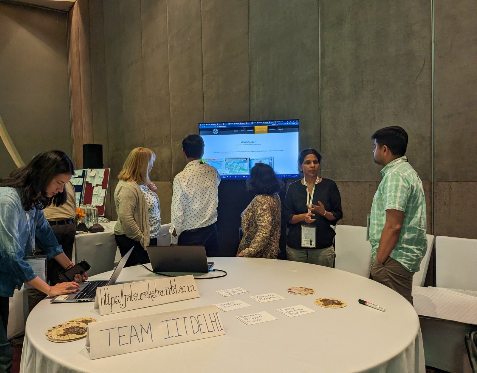
Dhanya and her team have built and are testing a real-time flood early-warning system at the Barapulla catchment
Here, her team has built and is testing a real-time flood early-warning system, combining rainfall monitoring, terrain modelling, and hydrological simulation to forecast where and when storm runoff will surge.
“It’s a system we built for the Barapulla catchment,” she says. “The idea is to give real-time warnings.”
Alongside Barapulla, Dhanya’s group also studies how Delhi absorbs heat, loses moisture, and reacts to sudden bursts of rain—work crucial for a city that swings between water scarcity and water excess within a single season.
“Chaos theory tells us systems can diverge drastically even with similar starting conditions, and that is exactly what we see in climate and hydrology.”
Reading India’s river systems
While Delhi’s Barapoola drain serves as her test bed for urban flood intelligence, Dhanya’s work stretches across some of India’s largest and most complex river systems, living waterways that behave differently under stress and reveal distinct signatures of a warming climate.
Fed by Himalayan snowmelt and monsoon rains, the Ganga is a study in compound risks: glacial inputs, upstream dams, and dense floodplains. Her lab models how rainfall bursts and heat spikes shape evaporation, runoff, and flood hazards.
The Godavari delta is a vast system where the river flows, tides, and land use intersect. Her team has built hydrodynamic simulations to predict how floodwaters spread across villages and farms under different rainfall and reservoir-release scenarios.
In the Tapi river basin, Dhanya and her team study how planned water releases interact with unplanned storms, showing that regulation does not eliminate risk—it rearranges it.
While the research is still in its early stages, the team hopes to eventually connect laboratory insights with on-ground outcomes—an essential step, Dhanya believes, to make the findings meaningful for policy and practice.
On the Tapi project, Dhanya is working with Yashas Kumar, a postdoctoral project scientist at HydroX. Kumar says the team is currently in the model-building phase. “We are still setting up the model,” he explains, adding that calibration and validation using historical data will come first. Once the model performs reliably for past conditions, it can be used as a base to simulate future climate scenarios.
Kumar contrasts the Indian situation with practices in the United States and Europe, where clean water policies require detailed accountability for pollution sources, particularly sediment. Sedimentation, he notes, contributes to flooding by accumulating in reservoirs. In these regions, hydrological models can estimate pollution contributions from individual farms—even at a national scale. “If you have a 100-hectare farm, you can quantify how much pollution it contributes to nearby streams,” he says.
India lacks comparable modelling capacity. According to Kumar, government agencies do not have a clear account of where sediment and other pollutants originate. While the Central Water Commission currently works at the sub-basin level, identifying precise locations—known as critical source areas—is extremely difficult under Indian conditions. Field-level modelling is especially challenging because landholdings are small, often measured in guntas rather than large, uniform parcels. “We don’t yet have the ability to work at that fine scale,” he says. This gap is what HydroX is trying to address.
India’s monsoon is becoming sharper, shorter, and more intense. Dhanya calls not for panic, but planning.
Once developed, the Tapi basin model will be able to incorporate extreme temperature, precipitation, and climate scenarios. “Then we can identify where water stress is increasing, where sedimentation is rising, and where flood risks are intensifying—potentially down to the village scale,” Kumar says. He adds that while many hydrological models used in India are developed in the US or Europe, Indian conditions are fundamentally different. “We need homegrown models built for Indian systems.”
Another strand of research at HydroX focuses on groundwater. Ishita Bhatnagar, an early postdoctoral researcher, studies how human pumping affects water exchange between rivers and aquifers, and how long-term extraction shapes groundwater “memory.” She distinguishes between shallow aquifers, which respond quickly to rainfall and pumping, and deep aquifers that were recharged millions of years ago and respond much more slowly.
Bhatnagar worked on the entire Ganga basin, building a MODFLOW groundwater model to examine how groundwater levels evolve over time. She found that pumping exceeds recharge by about 40 millimetres, but the consequences of this imbalance may take 10 to 20 years to become visible. Even when pumping is reduced, recovery can be delayed due to dampening and memory effects—a phenomenon sometimes referred to as the groundwater paradox.
With nearly 80% of irrigation dependent on groundwater, Bhatnagar argues that understanding these time lags is critical for policymaking. “If recovery takes decades, policies must persist for decades,” she says. Rather than relying on simple trend lines, she emphasises the need to account for complexity and memory in subsurface systems. Dhanya, her supervisor, played a key role in shaping this work, particularly its mathematical and statistical foundations.
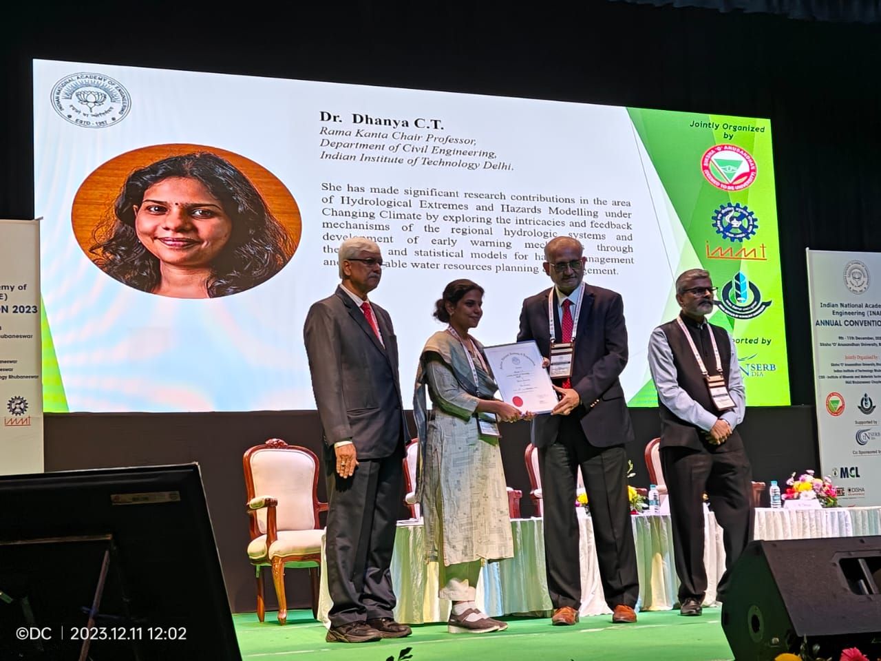
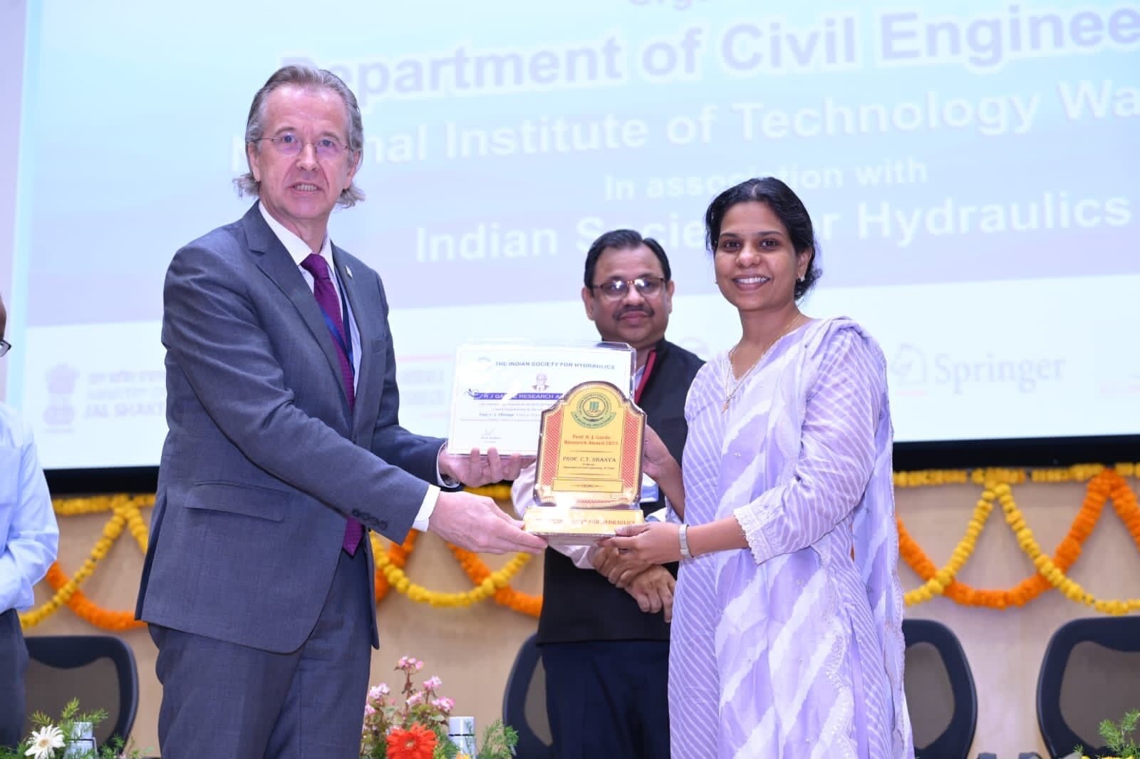
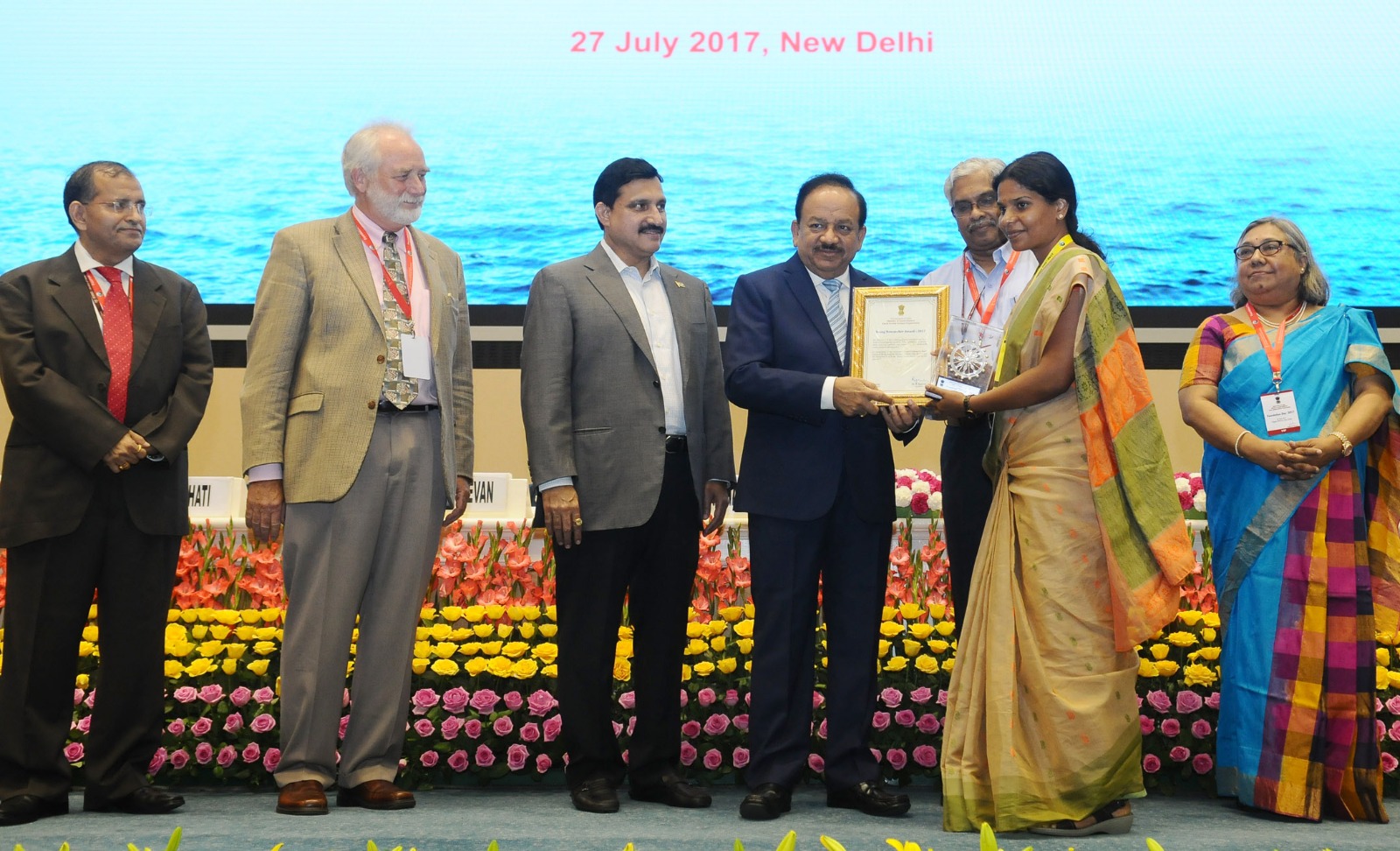
Being inducted as an Indian National Academy of Engineering (INAE) Young Associate in 2023. That same year, Dhanya was also an Indian National Science Academy Associate Fellow
Chaos as Compass
Dhanya’s intellectual compass is chaos theory, which she adopted during her PhD.
“Chaos theory tells us systems can diverge drastically even with similar starting conditions, and that is exactly what we see in climate and hydrology.”
For decades, Indian water planning assumed predictability. Today, rain arrives in sudden torrents, rivers surge unpredictably, and drought can set in after a single failed season. What once looked like climate misbehaviour now reads, in her lab, as information, order hiding in apparent disorder.
Instead of promising perfect prediction, her models aim for anticipation, identifying windows of risk before they open. Flood-warning systems are designed not for one future, but many. Drought tools adapt when rain falls at the wrong time or not at all.
“Our systems were built for a different climate. We are updating knowledge, not declaring a crisis.”
Building bridges
Thirteen years into her tenure at IIT Delhi, Dhanya’s focus is increasingly outward.
“I realised I need to make sure our tools are actually used. We are translating our research into usable toolboxes for government agencies,” she says.
Her team engages with institutions such as the Central Water Commission and the Delhi Jal Board, moving academic work closer to public-infrastructure relevance.
“You need to continuously push. They have their own systems. We have to fit into that,” she explains.
India’s water research community is vast, but Dhanya insists it thrives not on duplication, but on iterative evolution.
“Somebody asks a question, somebody else answers another side of it,” she says. “We learn from each other and build forward. That’s how science grows.”
Her fascination with climate extremes has taken her beyond India. While analysing drought behaviour, she began to see similar signals in Madagascar—a leap driven by data rather than field travel.
“After studying droughts across India, I found myself deep in climatic patterns in Madagascar—a surprising turn that emerged from comparative analysis.”
The work helped her test which climate mechanisms are universal and where local environments defy them.
“Research is never finished,” she says. “You keep seeing new questions.”
Preparing India
India’s monsoon is becoming sharper, shorter, and more intense. Rivers swell in hours; drought creeps quietly. Dhanya treats this not as a call for panic, but for planning—building systems that offer foresight rather than fear.
She imagines cities with storm warnings hours in advance, flood maps that update dynamically, and drought forecasts as precise as cyclone tracks.
“Reality is complex, but patterns exist,” she says.
Because in the end, chaos is not the climate breaking, it is the climate speaking. And Dhanya is teaching India how to listen.

About the author
Puja Bhattacharjee is an independent journalist based in Kolkata and writes about health, science, environment, gender, justice, rights, policy and culture.
Add a Comment